
Start with the route that fits your trip.
For high-elevation mountain views, choose Beartooth or Cloud Peak Skyway. For history and wildlife, try Black Hills. For red rock and open country, head to Flaming Gorge. For a quieter backcountry feel, choose Red Gulch Alkali. For a relaxed valley drive with small-town stops, follow Star Valley.
When Is the Best Time to See Fall Color in Wyoming?
Plan most fall foliage trips for September through mid-October, but use elevation to fine-tune your timing. Higher mountain routes can show color earlier, while lower valleys may still have yellow and gold leaves later in the season. Weather can shorten the display, and snow can arrive early at high elevations, so build flexibility into your plans rather than treating one date as a guarantee.
High-elevation roads deserve extra attention. Beartooth Highway and Chief Joseph Scenic Byway are especially weather-sensitive near Yellowstone. Check current conditions before you go and be ready to change your route if winter weather moves in.
Where Should You Drive for Fall Color in Wyoming?
1. Beartooth Scenic Byway
68 miles total | Nearly 39 miles in Wyoming
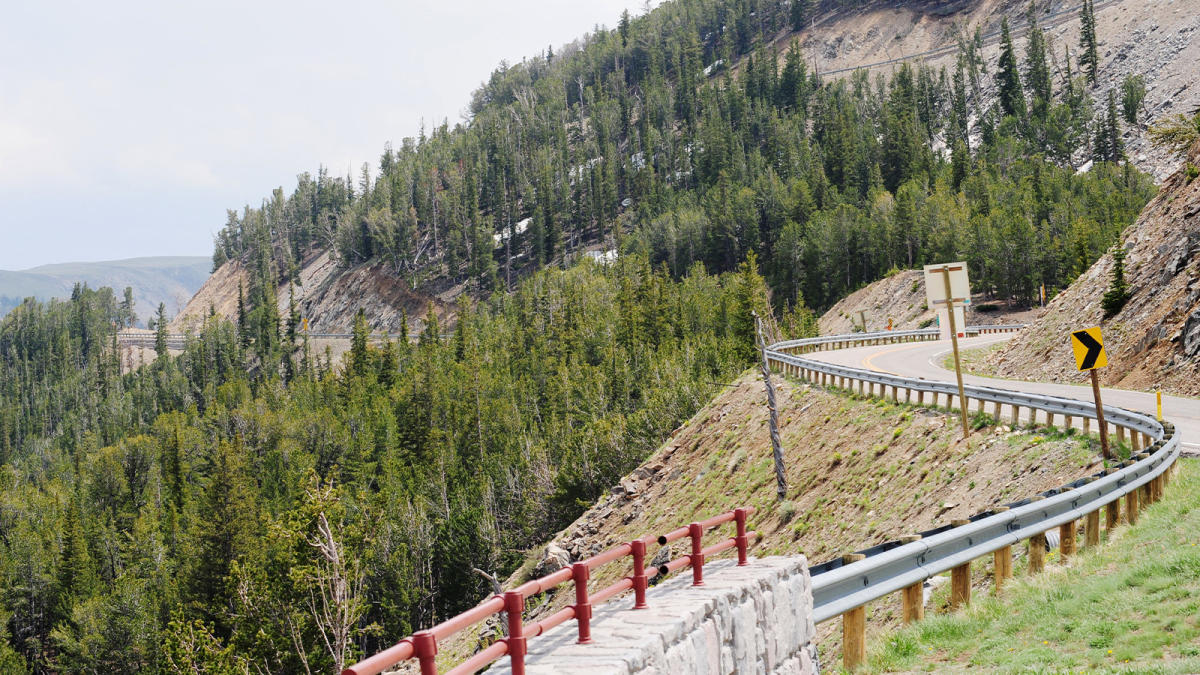
Beartooth is the pick for dramatic mountain scenery. US-212 climbs through Shoshone National Forest toward the Beartooth Mountains, with the Wyoming portion leading toward Yellowstone’s northeast entrance. The route is high, exposed and weather-sensitive, which is part of its appeal and part of the reason to check conditions before you leave.
Who is it best for? You want big mountain views, photography opportunities and a drive that feels like an adventure in its own right.
Make a day of it: Start or end in Cody by connecting through Chief Joseph Scenic Byway, or pair the drive with a Yellowstone visit through the northeast entrance.
What to look for: Aspens, alpine terrain, broad overlooks and the transition between forest and high-country landscape.
Planning note: The route crosses a high-elevation pass and can close with winter weather. Yellowstone National Park treats Beartooth Highway as a seasonal high-elevation road, with dates subject to change.
2. Cloud Peak Skyway
47 miles | U.S. 16 between Buffalo and Ten Sleep
Cloud Peak Skyway crosses the southern Bighorn National Forest and connects Buffalo and Ten Sleep. The paved two-lane route climbs to 9,666-foot Powder River Pass, giving you a concentrated mix of canyon scenery, forest and mountain views without requiring a full-day detour.
Who is it best for? You want classic aspen color, mountain scenery and easy add-on stops in two approachable Wyoming towns.
Make a day of it: From Buffalo, combine the drive with time in town before or after the byway. From Ten Sleep, continue into Ten Sleep Canyon and build in time for a hike or picnic.
What to look for: Golden aspen stands, higher-elevation viewpoints and the dramatic change from the Big Horn Basin into mountain country.
Planning note: Allow at least an hour to drive the route without stops. Mountain weather can change quickly at higher elevations.
3. Black Hills Scenic Byway
78 miles | Wyoming Black Hills near Newcastle
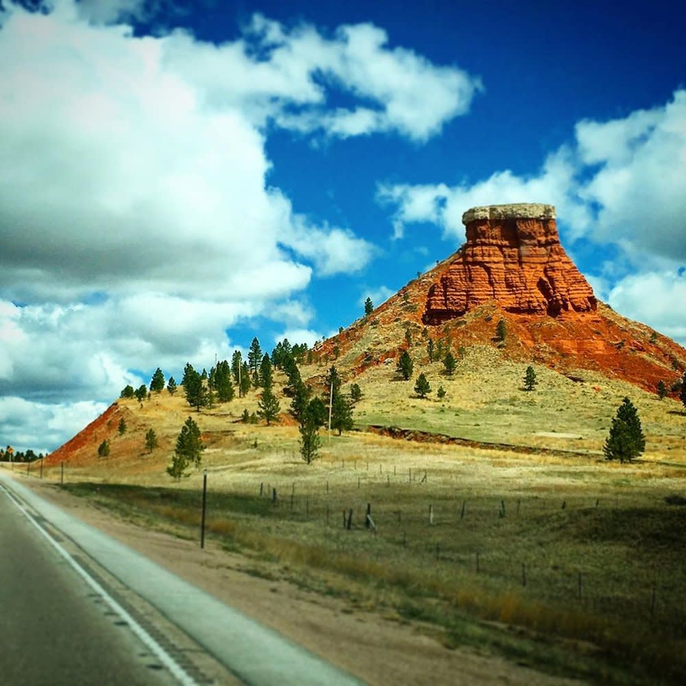
The Black Hills Scenic Byway is a strong choice when you want fall color with a mix of prairie, forest and history. The route sits at the western gateway to the Black Hills and gives you a different fall landscape from the high mountain drives farther west.
Who is it best for? You want a slower sightseeing day that mixes scenery, wildlife, geology and historic context.
Make a day of it: Use Newcastle as a starting point and build in time for hiking or short stops before continuing toward Devils Tower or Sundance.
What to look for: Patches of bright deciduous color set against evergreen forest and open grasslands, plus the distinctive geology of the Black Hills.
Planning note: The Wyoming Black Hills work well for travelers who prefer a quieter scenic route than the better-known South Dakota side.

4. Flaming Gorge - Green River Basin Scenic Byway
100 miles | Starts west of Rock Springs and loops back to Green River
This is the route to choose when you want fall scenery without staying in the mountains. The Flaming Gorge - Green River Basin Scenic Byway runs south from west of Rock Springs through high desert, red-rock country and the Green River drainage before reaching the Flaming Gorge area. Plan for a minimum drive time of about three hours before adding stops.
Who is it best for? You want open space, red rock, reservoir views and a longer road trip with room to stop in communities along the way.
Make a day of it: Pair the route with Flaming Gorge National Recreation Area, then spend time in Rock Springs or Green River rather than treating the byway as a drive-through.
What to look for: Contrasting landscapes: tree-covered mountain slopes, open high desert and the deep blues and reds of Flaming Gorge country.
Planning note: Fall color here is less about one continuous wall of yellow leaves and more about the way trees, shrubs and open country change as the landscape shifts.
5. Red Gulch Alkali Backcountry Byway
32 miles | Shell to Hyattville
Red Gulch Alkali Backcountry Byway is the quietest and most rugged route on this list. The 32-mile backcountry byway runs between Shell and Hyattville and includes a primarily unpaved section. The scenery combines red rock, badlands, open country and views toward the Bighorn Mountains.
Who is it best for? You want a quieter road, unusual geology and the feeling of getting farther from the main highway.
Make a day of it. Start near Shell and pair the drive with Shell Falls, then continue toward Medicine Lodge State Archaeological Site near Hyattville.
What to look for: Hoodoos, rock layers and wide-open views that put fall color in a much broader landscape.
Planning note: Because this is a backcountry route with an unpaved section, conditions matter more than they do on a standard paved byway. Check the current road situation before setting out.
6. Star Valley Scenic Byway
80 miles | Idaho state line to the Lincoln-Teton county line
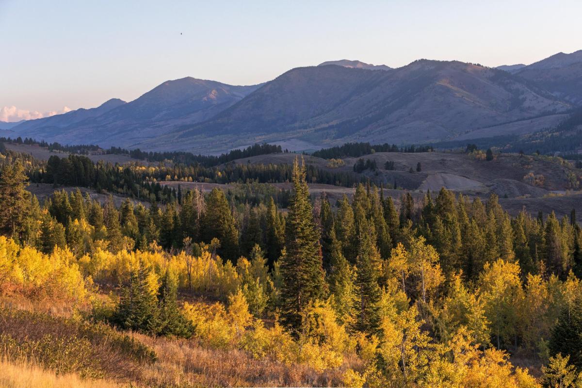
Star Valley Scenic Byway gives you a more relaxed version of fall road-tripping. U.S. 89 climbs Salt Canyon to 7,610-foot Salt River Pass before descending through Star Valley and its communities, including Smoot, Afton, Grover, Thayne and Etna. The route then continues east toward Snake River Canyon.
Who is it best for? You want a scenic drive with easy town stops, valley views and the flexibility to build in short walks or a longer overnight.
Make a day of it. Stop in Afton to see the World’s Largest Elkhorn Arch, then continue north through the valley. Near Afton, Periodic Spring is especially interesting in fall because its on-off flow is active from late August into May.
What to look for: Golden hillsides, mountain backdrops, ranch country and the shift from Salt Canyon into the broader valley.
Planning note: This route is especially useful as a connector. You can pair it with Jackson and Grand Teton National Park to extend a fall road trip.
How Can You Connect These Scenic Drives Into a Longer Trip?
Beartooth + Chief Joseph + Cody Use Cody as the Wyoming base, then connect north through the Absaroka Mountains toward Beartooth and Yellowstone’s northeast entrance.
Cloud Peak Skyway + Bighorn Scenic Byway Use Buffalo or the Bighorn region as your base and compare the two routes through the Bighorn Mountains for different elevations and views.
Black Hills + Devils Tower Build a northeastern Wyoming loop around the Black Hills, Sundance and Devils Tower rather than treating the byway as the only stop.
Flaming Gorge + Rock Springs + Green River Turn the 100-mile byway into a southwest Wyoming road trip with town stops, reservoir views and time in Green River.
Red Gulch Alkali + Bighorn country Pair the backcountry route with Shell Falls and other Bighorn-area scenery for a day centered on geology and mountain landscapes.
Star Valley + Jackson + Grand Teton Use the byway as the western leg of a broader fall trip that continues north or south through the Jackson area.
What Should You Know Before a Fall Drive in Wyoming?
Check road conditions the morning you leave. WYDOT 511 is the authoritative source for closures, restrictions and current road conditions in Wyoming. High-elevation routes can change quickly.
Plan around daylight. Fall days are shorter, and a route that is easy to drive in summer can feel rushed once you add overlooks, meals and short walks.
Bring layers. Mountain weather can feel much colder than the valley, especially early in the morning.
Keep your vehicle fueled. Long stretches of Wyoming road can connect small communities rather than large service centers. Start long drives with enough fuel for the route you have planned.
Use designated pullouts. Stop fully off the travel lane before taking photos or watching wildlife. Never stop in the roadway to capture fall color.
Build in room to linger. The point of a scenic drive is not to finish it as quickly as possible. Leave space for a town stop, a short walk or a viewpoint that deserves more time.