Discovering the Cloud Peak Wilderness
A trail report covering the 23-mile trek to Cloud Peak, with travel tips for hikers and notes on responsible recreation.
After two backpacking trips in the Wind River Range and half a dozen visits to Grand Teton National Park, I became keenly interested in exploring Wyoming’s lesser-traveled Bighorn Mountains. Located in the north-central region of the state, Bighorn National Forest covers over 1.1 million acres, including 189,000 acres in the stunning Cloud Peak Wilderness. When searching for backpacking trails, one kept popping up at the top of everyone’s list: Cloud Peak, the high point of the Bighorns. At 13,167 feet, this summit would be a high point for me, too.
Choosing a Route to Summit Cloud Peak
The main out-and-back route to Cloud Peak begins at the West Tensleep Trailhead, logging approximately 5,300 total feet of gain over 23 miles. Another route starts at the Battle Park Trailhead, with approximately 6,000 total feet of gain over the course of a 24-mile loop. These trails intersect near Paint Rock Creek and share the same route to the summit, which is a little over three miles with 3,000 feet of gain. While Cloud Peak is not a technical climb, it is best suited for intermediate hikers with route-finding experience, as some sections do not have a trail. I didn’t want to be rushed, so I opted to do the hike as a two-night backpacking trip via the West Tensleep Trailhead.
Cloud Peak Summit Itinerary
Day 1: West Tensleep Lake Campground to Mistymoon Lake
The West Tensleep Lake Campground is half a mile from the trailhead, and 40 free, numbered, dispersed campsites sit along the road to the trailhead. My friend and I snagged a quiet campsite at nearly 9,000 feet, and I was grateful to have a night to acclimate to the elevation. The next morning I filled out a free, self-issued wilderness permit at the trailhead, and we were off. I was pleased to see plenty of signage reminding hikers to camp at least 100 feet from water sources, and to bring Waste Alleviation and Gelling (WAG) bags or portable toilets for human waste. These U.S. Forest Service regulations were established primarily to help prevent contamination of lakes and creeks in the Cloud Peak Wilderness, as the area has seen an increase in visitation over the years.
What is a WAG bag? Check out this short video from Leave No Trace with the full scoop on how to use one and how they work to neutralize human waste.
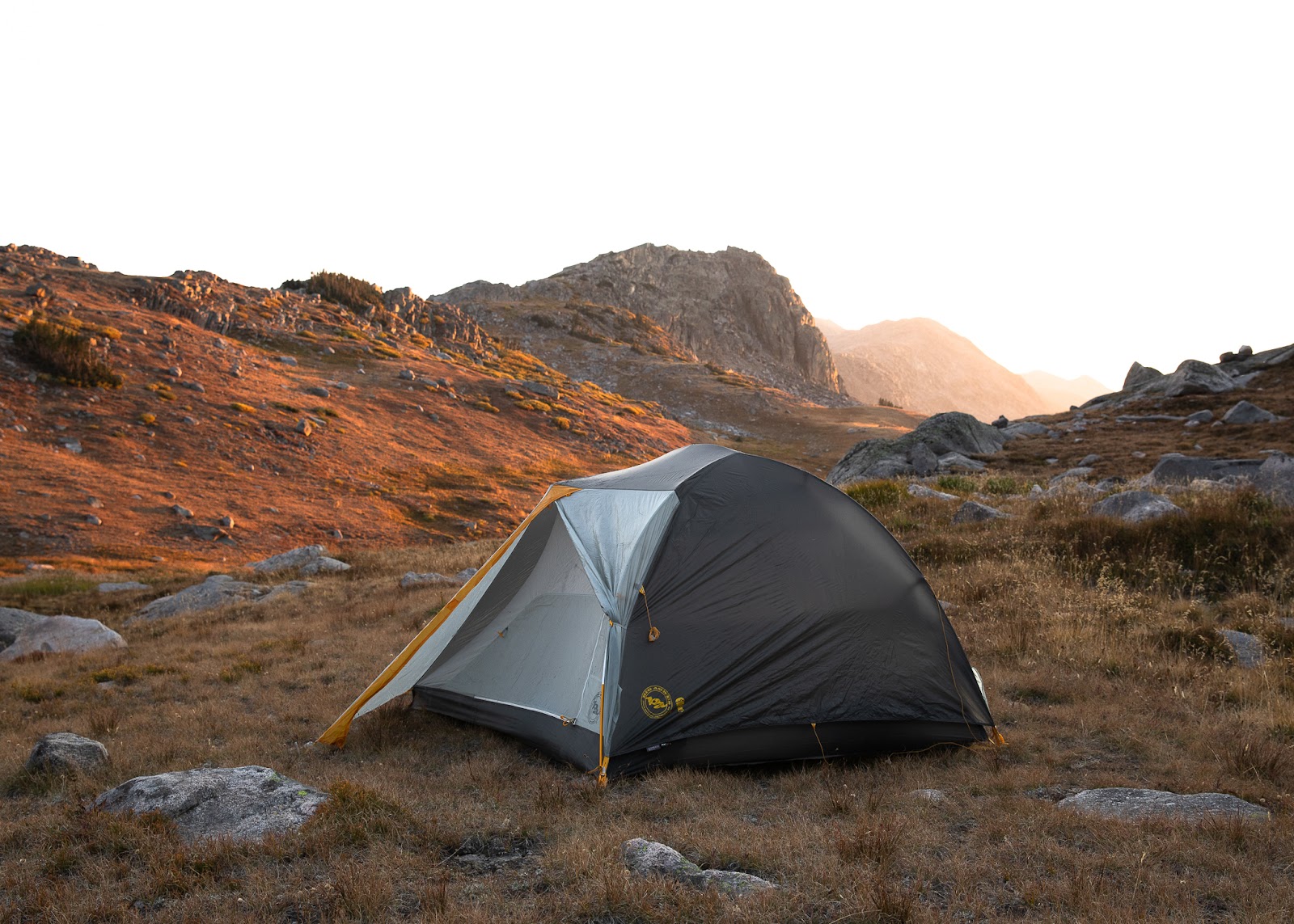
After seven miles and about 1,150 feet of gain, we arrived at Mistymoon Lake, and our quest to find a campsite was interrupted by a bull moose sighting. We observed the animal from a safe distance (it’s recommended to stay at least 75 feet from moose, elk and deer, and 300 feet from bears and wolves), and we hiked another half a mile before finding a suitable spot to pitch our tent. We stored all food and toiletries in our bear canister, which was kept far from our campsite. Though the Bighorns aren’t known to have grizzly bears, they are home to a healthy population of black bears, so in addition to proper food storage, hikers are advised to carry bear spray and make plenty of noise on the trails, and to never approach or feed wildlife.
Find more information on how to be safe around wildlife through this article. For tips on how visitors can minimize impact and help protect Wyoming’s beautiful public lands, please visit the WY Responsibly page.
Day 2: Mistymoon Lake to the Summit of Cloud Peak
The original plan was to start the trek to Cloud Peak around 5 a.m., with 1 p.m. as our turnaround time. The Bighorns are known for late afternoon thunderstorms and unpredictable weather; just two weeks before we visited in early September, Cloud Peak received nearly a foot of snow. But much to our delight, there wasn’t a cloud in the sky, the wind was mild, and all weather reports showed perfect conditions into the night. Not only could we sleep in, but we’d be able to watch the sunset near the top. Of course, this meant hiking back in the dark, but we were fully prepared and confident with our revised plan.
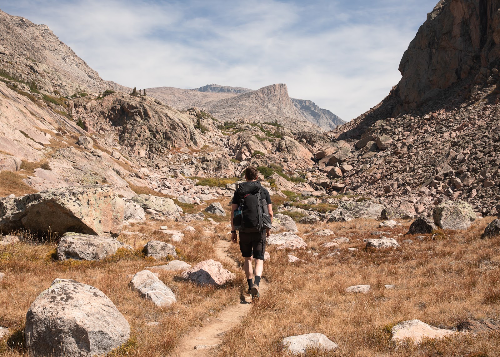
We enjoyed a leisurely breakfast and moved camp closer to the waterfall at Paint Rock Creek, which shaved off some distance on our return. We navigated one of several goat trails around the waterfall, and from there we followed a more visible path for a mile, marked by the occasional cairn. And then the infamous boulder field began…
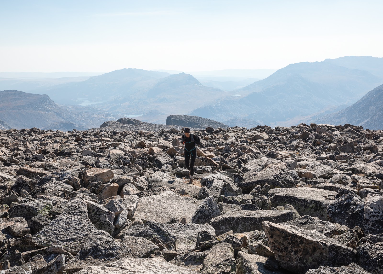
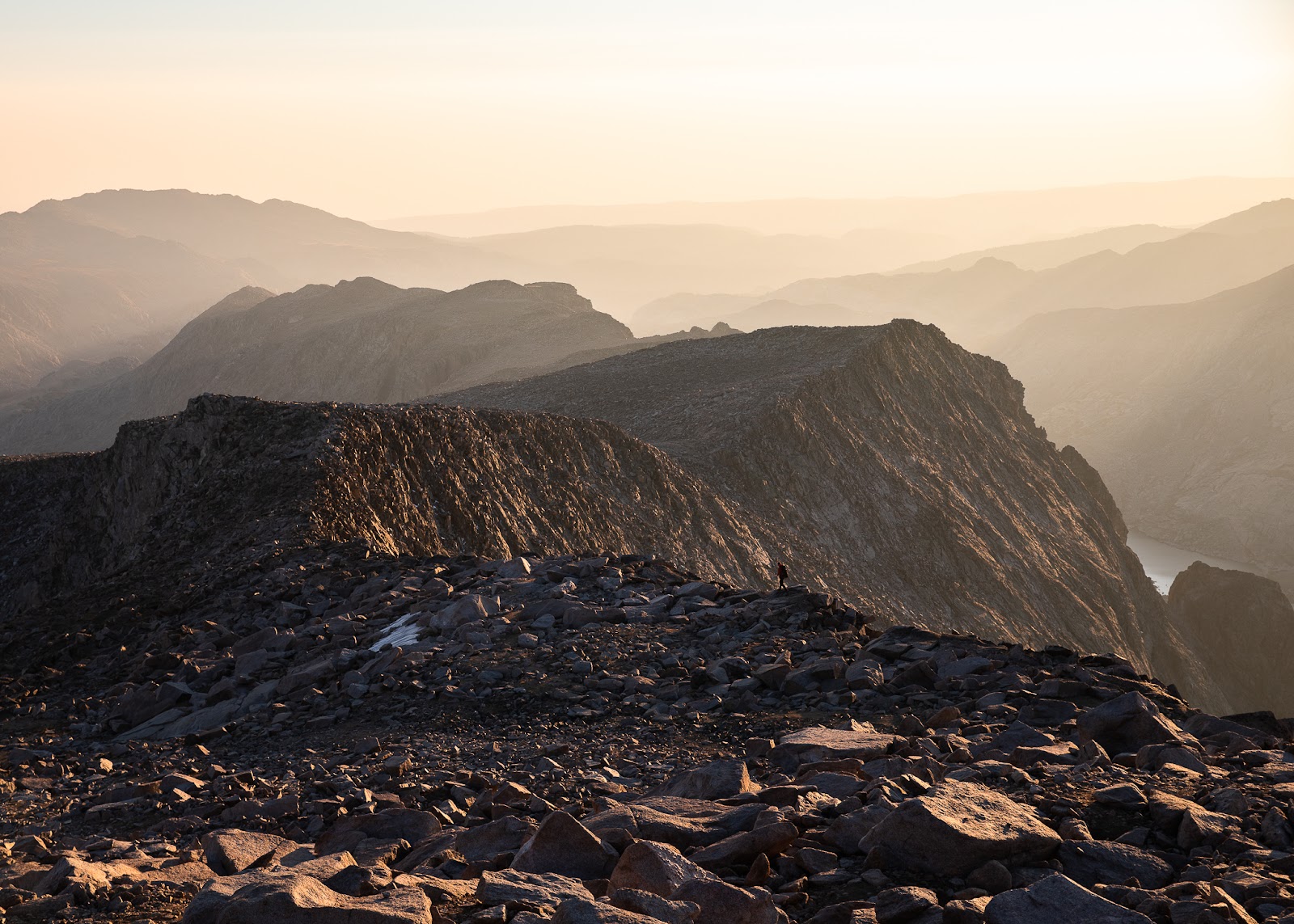
While it’s not steep or technical, ascending a sea of large rocks is a laborious task, especially when you’re approaching 11,000 feet. After another 1,500 feet of gain over the next mile and a half, we were ready for a break — and nearing the final ridge to the summit. The quarter-mile ridge isn’t super exposed, but every move matters, whether it’s with your feet or your hands. At over 12,500 feet, this isn’t the kind of place you want to make a mistake, especially if the weather isn’t in your favor.
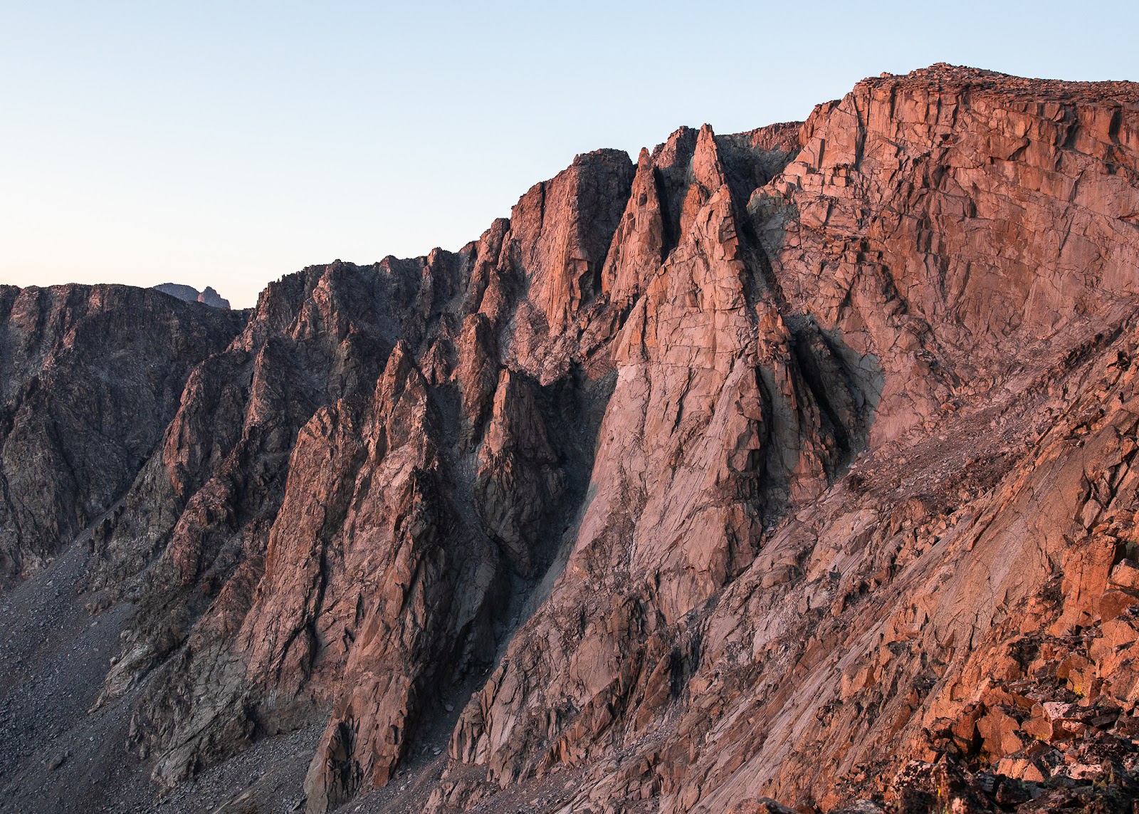
We had a final half-mile push with 600 feet of gain, and after a few minutes of mellow rock scrambling, we finally stood on the summit. To the west, the mountain layers glowed under the low sun and seemed to go on forever. We peeked over the edge on the east and marveled at the Cloud Peak Glacier below. Even under the shadow of Cloud Peak, the glacial lakes were exquisite hues of blue and aqua. Within three minutes I threw on a puffy jacket and gloves, and after hanging out for another twenty minutes, we started the journey back down.
We were past the ridge by the time the sun set, and after about twenty minutes on the boulder field, we turned on our headlamps. We found hints of a trail on the left side of the bowl, but it eventually disappeared and we resumed trudging over boulders. When we arrived back at a familiar tarn, we refilled our water and took a quick dinner break, and within an hour we were at camp. We stuffed our food waste in the bear can, cozied up under our sleeping bags and didn’t bother setting an alarm.
How I Prepared for My Cloud Peak Summit
In addition to headlamps, snacks and layers, we carried Garmin InReach GPS devices, a portable power pack, a first aid kit and maps. We used the Gaia iPhone app to navigate and track our route, saving our Garmin for weather updates. Prior to the hike, we spent several hours combing through trail reports and examining the terrain on Google Earth, so we knew exactly what we were getting into. Finally, I had a partner I could trust, so I felt comfortable abandoning the alpine start and turning our summit bid into a sunset hike.
We were gone from 11 a.m. to 11 p.m., and we spent seven hours ascending and five hours descending. If we hadn’t stopped to take photos, we could have done it in 11 hours, but either way, Cloud Peak is an all-day adventure. I chose to do it in two nights and three days because I wanted to appreciate the stunning alpine scenery, but mostly because I didn’t want to hike 7.5 miles with an overnight pack immediately after summiting Cloud Peak. Planning is important, but knowing your limits is equally crucial for safe and stress-free adventures in the backcountry. Search and Rescue teams will certainly thank you for it, too.
This hike was the definition of humbling. It took all day, and a few times I didn't know what was burning more, my lungs or my legs. But it lifted me up in a way I simply can’t explain. As I sat down to photograph the alpenglow on the face of Cloud Peak, it finally registered: I just hiked that, and that’s the highest peak I’ve ever done. The very next thought? I need to spend more time in Wyoming, and maybe next year I’ll even tackle my first 14er…