Extraordinary geology is a big draw to Wyoming, and you don’t have to be a geologist to appreciate it. Whether it is the 1,200-foot-tall pillar of igneous rock known as Devils Tower or majestic Yellowstone National Park with its geothermal springs, Wyoming’s geology is iconic. Learn the science behind these five geological wonders and impress your friends on your next road trip through Wyoming.
1. Wind River Canyon
The walls of the Wind River Canyon are narrow, providing space for only the highway, river and railroad track. As you drive through the canyon, the highway tunnels through Precambrian rock as old as 2.9 billion years three times.
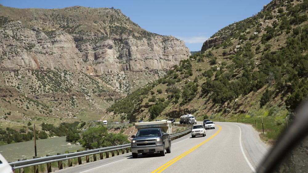
Wind River, which runs next to the highway, seemingly defies logic by cutting straight through the Owl Creek Mountains. “Superimposed streams” like this are surprisingly common in Wyoming. One theory is that the course of the river was established while the resistant rocks that make up the mountains were still buried, and as the mountains were uncovered, the river stubbornly kept to its course, carving its canyon.
You can enjoy the river and view the canyon by taking a road trip along the Wind River Canyon Scenic Byway or get a more personal look through a white-water rafting or fly-fishing trip.
2. Hell’s Half Acre
Hell’s Half Acre, just off U.S. Highway 20/26 between Casper and Shoshoni, resembles an alien landscape. You’d be right if you said it looks like something you’d see in the movies (think Starship Troopers).
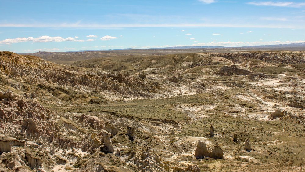
Hell’s Half Acre is a prime example of badlands topography, with unusual and spectacular rock formations created by the erosion of relatively soft sedimentary rocks. Layers at Hell’s Half Acre are nearly horizontal, but beneath these flat layers are older layers that were tilted on their side during the same tectonic event that lifted the rocks of many of Wyoming’s mountain ranges. This wonder is full of hiking trails and wildlife.
3. The Sinks and Rise
On the eastern slope of the Wind River Mountains abutting the city of Lander, the middle fork of the Popo Agie River mysteriously vanishes underground only to reappear 2,000 feet, as the crow flies, downstream. The geologic enigma is known as the “Sinks.”
Near the canyon’s entrance, the river vanishes into a cave in the 220-million-year-old Mississippian Madison Limestone. The cave is part of a karst system, which is a series of underground lakes, caves and aquifers formed by dissolution of limestone by the groundwater.
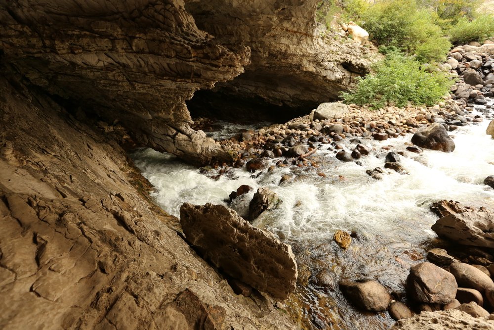
The river re-emerges less than a mile downstream and on the other side of the Highway 131 at the “Rise.” The calm pool of water at the rise is home to enormous rainbow trout.
Scientists in 1983 set out to determine whether the water at the Rise was the water at the Sinks. They discovered that it took two hours to pass from the Sinks to the Rise. They also found more water flows out of the Rise than into the Sinks, and the water is warmer when it comes out of the Rise. This phenomenon remains a mystery.
This geological wonder can be found in Sinks Canyon State Park, along with other hikes, rock climbing, fishing and camping opportunities.
4. Ten Sleep Canyon and the Cloud Peak Skyway
In its journey over the Big Horn Mountains, U.S. Highway 16 climbs through not only 5,000 vertical feet of mountain scenery but also billions of years of geologic wonder.
Hills of vivid red Triassic and Permian rocks form the high-desert backdrop to the town of Ten Sleep. Four miles east of town, the Cloud Peak Skyway follows the erosive result of Ten Sleep Creek upstream into the canyon, where the road winds its way back in time past increasingly dramatic cliffs of sandstone, limestone and dolostone.
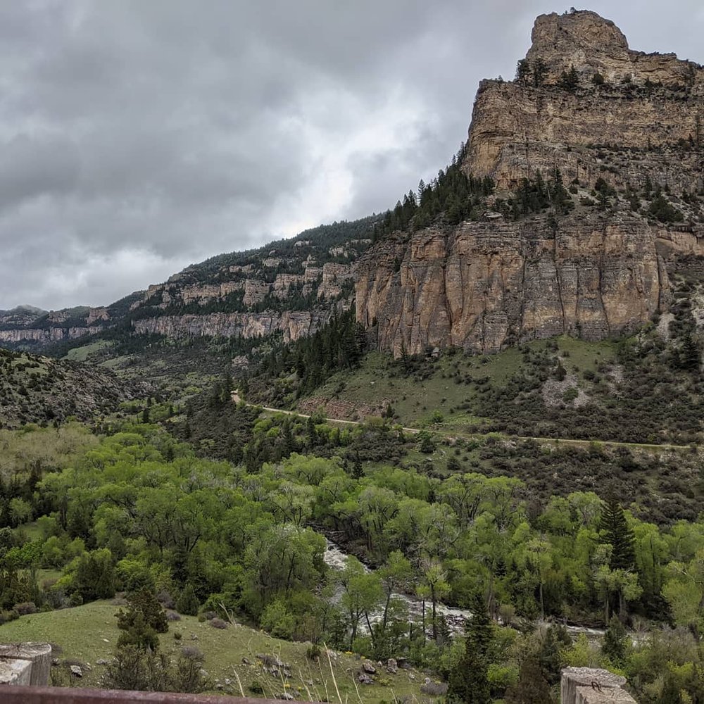
Be on the lookout for the rock climbers and recreational users who actively enjoy the geologic treasures found in the canyon. After about 5 miles of breathtaking canyon walls, the landscape opens, and the transition from high desert to Ponderosa Pine forest is complete.
Near Meadowlark Lake an apron of glacial debris, deposited during the last ice age, conceals the 2-billion-plus-year age gap between the rocks of the canyon walls and the Precambrian rocks that form the high peaks of the Bighorn Mountains. The Cloud Peak Skyway continues its climb to Powder River Pass, at 9,666 feet, where the road begins its 35-mile, 5,000-foot descent to the town of Buffalo. It even passes a road cut through the Clear Creek fault, which uplifted the entire mountain range.
5. Seminoe State Park
There is a stark contrast between the vibrant red and tan rocks and the bright blue reservoir water at Seminoe State Park, a hidden gem tucked away north of Interstate 80 in the south-central part of the state.
From 2.7-billion-year-old rocks to active sand dunes, the geology exposed in the park records an exciting history of rock formation, uplift and faulting. This history is clearly exposed in the Seminoe Mountains, where tilted, near-vertical layers of red and white rise above the north end of Seminoe Reservoir.
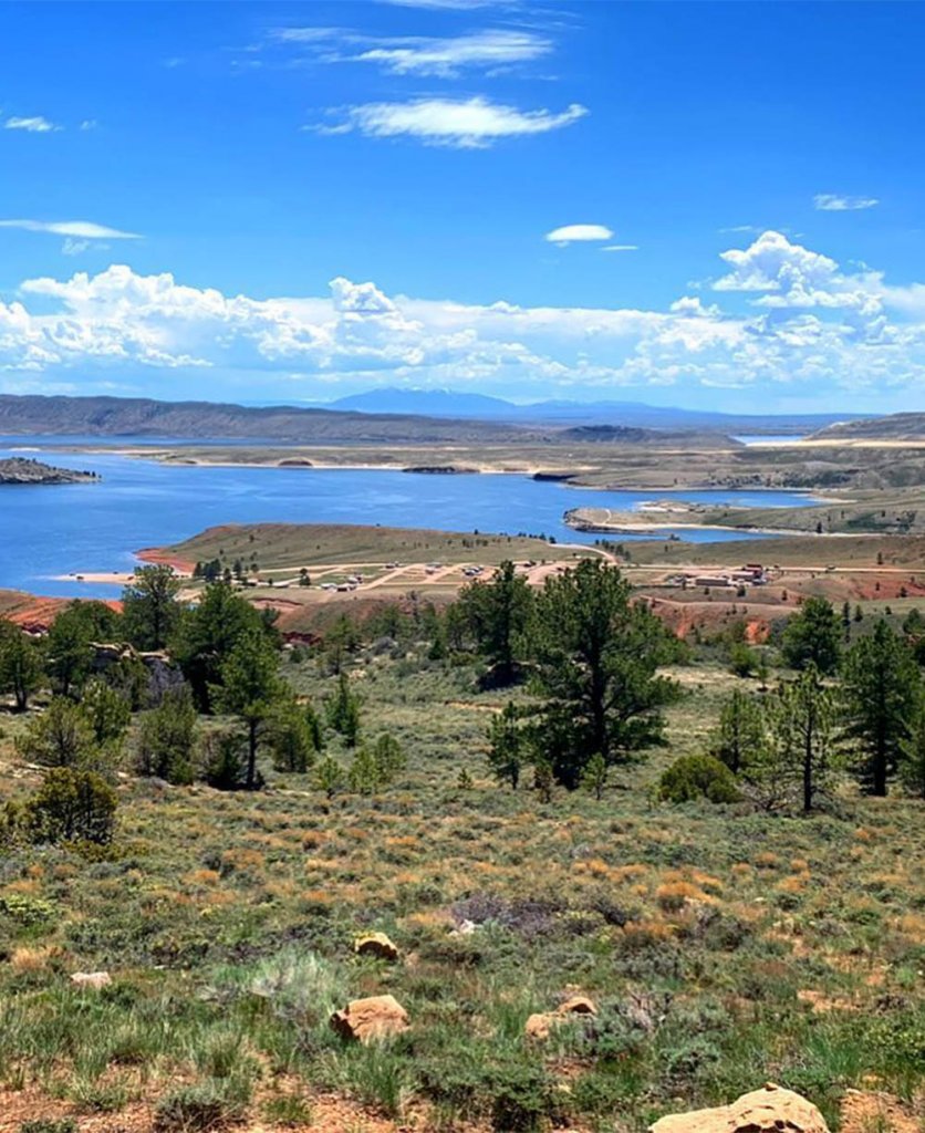
This area is perfect for hiking, water sports and enjoying the spectacular views.
As you can see, Wyoming is a great place to tour for interesting geology. Every highway offers a route to breathtaking canyons, colorful rock formations, unique hydrogeologic processes and more.